Council committee recommended to reject controversial Sunderland University planning application


Sunderland University put a 9.9 acre field it owns off Weardale Avenue up for sale earlier this year and marketed it as an ‘excellent residential development.’
It subsequently submitted plans to Sunderland City Council to use the plot for stables - but local residents were concerned the move was intended to make the land more attractive to developers by allowing it to be classed as a brown field site.
Advertisement
Hide AdAdvertisement
Hide Ad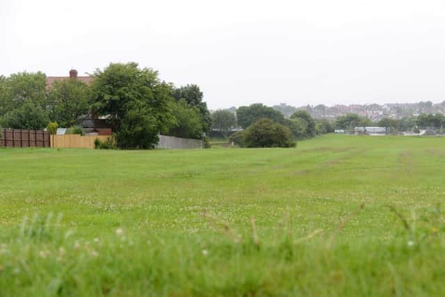
The university has said the stable scheme is a stop-gap plan until its future is agreed in the long term.
The plan is due to be considered by a meeting of Sunderland City Council’s Development Control (North Sunderland) Sub-Committee at 3.45pm today.
Members will hear Sunderland Central MP Julie Elliott and local ward councillor George Howe are among those objecting to the plans.
Julie Elliott MP wrote: “I object to this application because the enclosure would prevent access for people to use a walk way which crosses through this area.
Advertisement
Hide AdAdvertisement
Hide Ad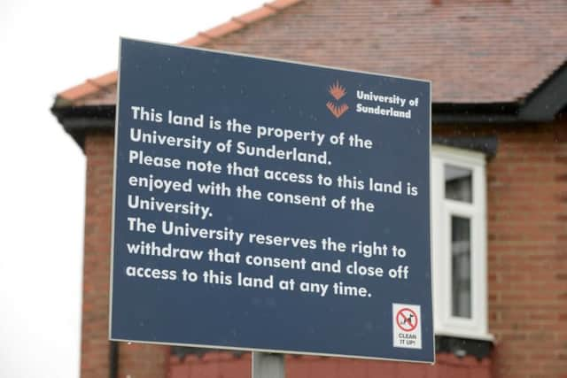
“I have lived in Whitburn, Fulwell and Roker my entire life and have used this walk way regularly. I am, therefore, familiar with this particular plot.
“The path way which runs through the site is well used by many people on a daily basis and has been for my entire life and probably for many years before that. The path provided well-established linkages between communities which are needed.
“I object strongly to this application. I believe we must preserve the right to walk through these fields in whatever development occurs on this land in the future and that this is nonnegotiable.”
Coun Howe said: “I object strenuously to the application. It should remain as an green space.”
Advertisement
Hide AdAdvertisement
Hide AdA report to this afternoon’s meeting recommends councillors reject the plan on the grounds the application does not contain enough information about the impact on traffic in the area.
“The Design and Access statement does not provide a sufficient level of information on the type and number of vehicles expected to visit this proposed use,” it says.
“Further consideration needs to be given to the layout and location of the site access and treatment with regard to enclosures of the site boundary.
“Further to discussion with the agent, it has been confirmed that no additional information will be submitted in respect of the highways issues raised. Therefore, the proposed development cannot be supported on highway grounds, due to insufficient information to consider the application.”
Advertisement
Hide AdAdvertisement
Hide AdIt concludes: “The Local Planning Authority is unable to fully assess the application and as such it is recommended that members refuse the application based on lack of sufficient information to justify the loss of the allocated open space and the need to demonstrate its replacement and due to lack of information to fully assess the impact of the proposed development on the highway network.
“Therefore, the proposed change of the land can not be fully evaluated as all material considerations are not present.”