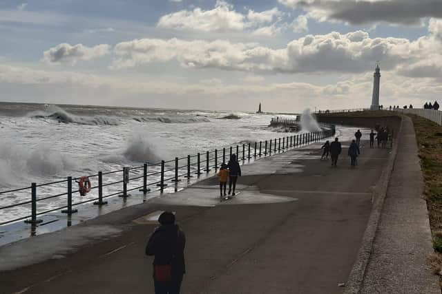
Footage shows high waves crash onto promenade at Seaburn as windy weather forecast throughout the week
and live on Freeview channel 276
High winds have seen waves crashing over the promenade at Seaburn and the gusty weather is set to last for another two or three days.
Waves between 9ft and 14ft have been forecast for Tuesday afternoon, with waves as high as 16ft expected overnight into Wednesday morning.
High waves of up to 10ft are predicted on Wednesday.
Advertisement
Hide AdAdvertisement
Hide Ad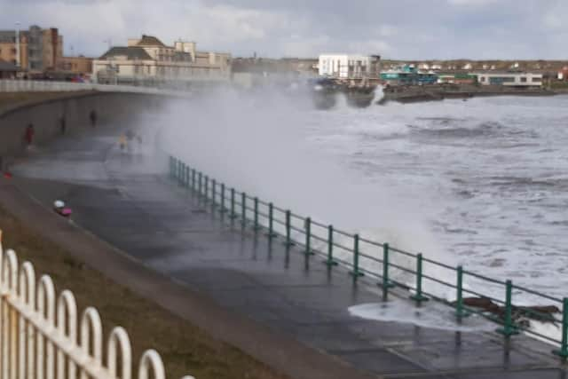

Scattered snow showers have also been forecast for the region on Tuesday and it is set to stay cold as the maximum temperature of 4C will feel more like -2C, thanks to a ‘significant wind chill’.
Overnight into Wednesday temperatures are expected to drop to -2C with a widespread frost.
Winds could reach up to 29mph in the late evening and overnight but are set to ease tomorrow.
Wednesday will be less cold and generally cloudier, though dry and bright with some morning sunshine and a maximum temperature of 6C.
Advertisement
Hide AdAdvertisement
Hide AdRain overnight may be preceded by a bit of snow over high ground.
The high winds return on Thursday, with gusts of up to 33mph with cold wintry showers forecast for Friday and Saturday.